Riggindale Horseshoe
A long round which commences with the delighful climb of Long Stile. This walk takes in five Wainwrights: High Street, The Knott, Rampsgill Head, High Raise and Kidsty Pike.
Start / End: car park at Mardale Head.
Time: 5 to 6 hours.
Looking back to the start of the walk from the path alongside Haweswater reservoir. Cars parked at Mardale Head visible to the left of the photo. Looming above is Harter Fell.
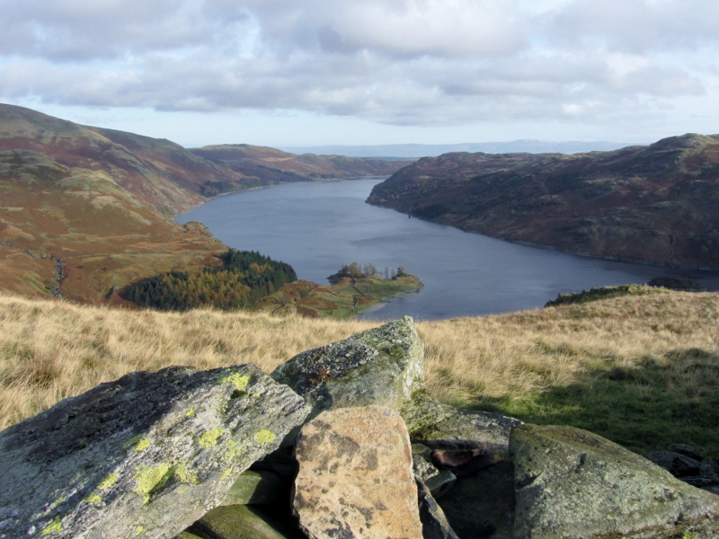
A view along Haweswater from a shoulder near the foot of the Long Stile ridge.
Reverse direction from the previous photograph, looking up the ridge towards High Street.
Rampsgill Head from a mid point on Long Stile.
The upper section of the ridge, which is steep in places but never a scramble.
View south from The Knott. The mountain in cloud is High Street.
View to the west from the ridge between Rampsgill Head and High Raise. The prominent central peak is Catstycam, with clouds brushing the summits of Helvellyn and Nethermost Pike.
High Street from Kidsty Pike.
Descending from Kidsty Pike. Haweswater and the Rigg are in view to the right.
Riggindale, with Kidsty Pike in sunshine. Eagle Crag, home to England's last golden eagle - a solitary male - is in shadow to the left.
Completion of the walk on the shoreline path along Haweswater.
Route ideas and information are from the Wainwright walking guides:


.jpg)


No comments:
Post a Comment