This round starts with a gentle walk up the Walna Scar Road before branching off for the ascent of Brown and Buck Pikes. From here it's a sustained high-level traverse of the Coniston Fells before a steep descent to Low Water and the ruins of Coniston's extensive copper mines. The round includes three Wainwrights: Dow Crag, Brim Fell, and The Old Man of Coniston.
Start / end: car park at the end of the Walna Scar Road. Reaching the car park involves driving up a steep and narrow lane - not for the faint hearted.
Time: 4 to 5 hours
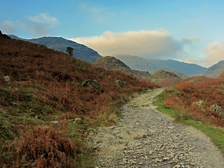
Near the start of the walk on the Walna Scar Road. The peaks in the distance are Brown Pike (left) and Buck Pike (centre) both of which are ascended in the early stages of the round.
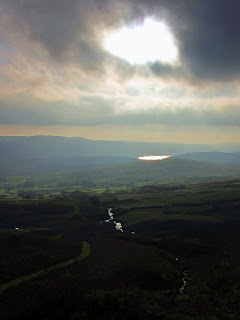
Red Gill Beck and a distant view of Coniston Water from the Walna Scar Road. From here, the Walna Scar path crosses marshy ground at the outlet stream from Goat's Water, before climbing steeply to the shoulder of Brown Pike. The Pike is ascended by leaving the Walna Scar path to the right, almost in a reverse of direction.
Coming off Buck Pike summit. The prominent peak to the left is Harter Fell. The path from here to Dow Crag is at times indistinct, but easy to follow along the crest of the ridge.
Dow Crag, the attainment of whose summit entails a mild scramble. Brim Fell is in cloud.
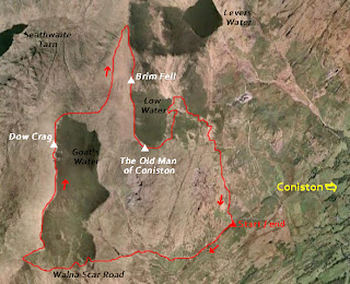
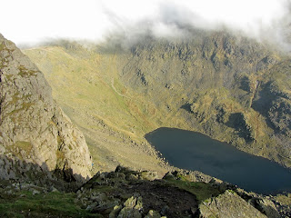
View down to Goat's Water from Dow Crag. Reaching Brim Fell entails a steep descent from Dow Crag, then a traverse to the left to gain the path to Brim Fell (see map). Alternatively, the traverse and summit of Brim Fell can be omitted from the round by heading straight up to the summit of the Old Man of Coniston. The summit is a superb viewpoint and suitably triangular in shape, unlike the flat felltops that predominate in the Lake District.
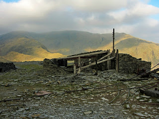
Ruined quarry buildings and narrow gauge railway tracks on the western flank of the Old Man of Coniston. Wetherlam in the distance.
Final stages of the descent. Coniston Water ahead.
A last look back at the Coniston fells as the path nears the car park.
Route ideas and information from the lovely Wainwright walking guides:

.jpg)



No comments:
Post a Comment