This is a long walk, nowhere particularly steep or arduous. It takes in five Wainwrights: Yoke, Ill Bell, Froswick, Thornthwaite Crag and Mardale Ill Bell. With a little extra effort, it would be no problem to add High Street (just off the map to the north of Mardale Ill Bell), Harter Fell and Kentmere Pike.
Start / end: Kentmere. Parking on the lane just beyond the church (honesty box).
Time: 6 to 7 hours.
The walk starts on the undulating road through Kentmere before heading up the Garburn Pass, passing a large boulder, known as the Badger Rock, as it slowly gains height. Above is the view down the track towards Kentmere from a point near the Badger Rock.
The track steepens as it nears the summit of the pass - view above - and should be left by taking a faint path on the right just after a gate.
The path cuts through marshes before joining a more substantial path (above) on the climb up to Yoke.
The ridge beyond Yoke leads easily to the summit of Ill Bell, dotted with several well constructed cairns.
From Ill Bell there is a steep descent to a col between it and Froswick, which appears in the above photo behind a brocken spectre - caused when the sun casts a shadow from behind the observer onto clouds below.
From the col, the path to the summit of Froswick is clearly visible, as is the path beyond to the beacon on Thornthwaite Crag, the rounded summit of which is the sunlit top slightly to the left of centre.
Looking back from the col to Windermere and the fields around Troutbeck. A right fork should be taken from Thorthwaite Crag to traverse the rim of Bleathwaite Crag and attain the summit of Mardale Ill Bell. From here it's a case of heading south to the shelter box at the summit of the Nan Bield Pass. From here, a track goes steeply up to Harter Fell and Kentmere Pike. A shorter option is to turn right, following the Pass down into Kentmere.
A long gentle descent to Kentmere follows, the steepest part of which is the descent past Tongue Scar and into Hollow Bank Quarter, seen in the photo above.
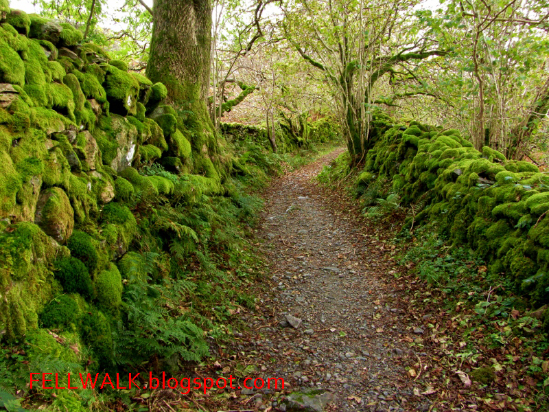
A delightful mossy lane leads back into Kentmere and back to the parking spot by the church.
More complete descriptions of the fells and paths described in this round can be found in Wainwright's Pictoral Guides.


+copy.jpg)


No comments:
Post a Comment